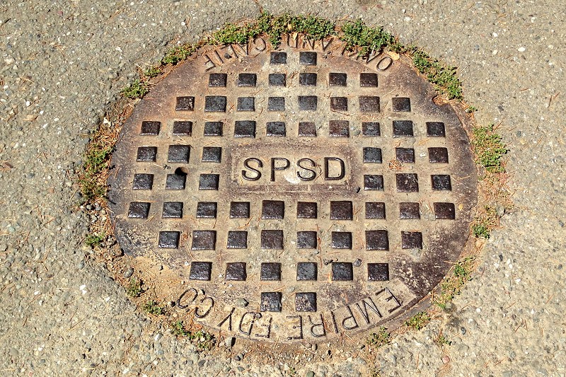
This utility hole cover sits on Keswick Court, on the south side of Shepherd Canyon. My searches for any information about SPSD have drawn a total blank. It might stand for the San Pablo Sanitary District, which existed from 1921 to 1978 when it became the West County Wastewater District. Maybe whoever installed the sewer line down Keswick bought SPSD’s outdated hardware, or the Empire Foundry had a stack lying around. I mean, who would care?
I have few other clues. Keswick was shown as unpaved on the 1947 topo map and paved on the 1959 edition, so the lid may date from the fifties. And yet Beaconsfield Road, just up the hill, contains a water main cap from Peoples Water Company, which ceased to exist in 1914. I can only assume that EBMUD used old PWC inventory when it pushed water service into the area.
For more clues, I must rely on the kindness of my readers.

Leave a comment